Cartouche (8)
All Resolutions

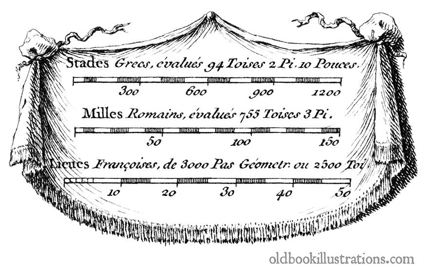
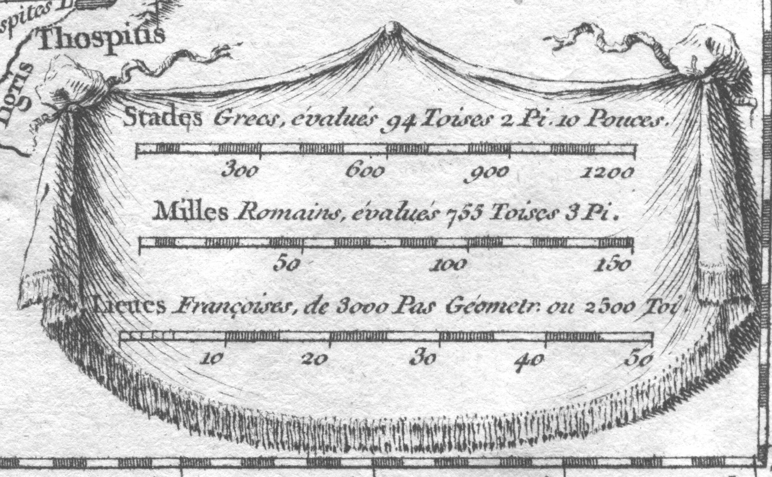
Draped cartouche showing ancient units for measuring distance.
Description:
Cartouche shaped as a drape showing ancient units for measuring distance such as stadion, Roman mile, and league.
The cartographer for this series of maps was Jean-Baptiste Bourguignon d’Anville. Jacques-Philippe Le Bas seems to have been consistently responsible for the artwork, although his name doesn’t appear on every map. The publication date we mention is that which appears in the cartouche (i.e. not necessarily the publication date of the book the map refers to: we don’t know if the maps were included with the books or published separately).
Share this: 


▲ Top